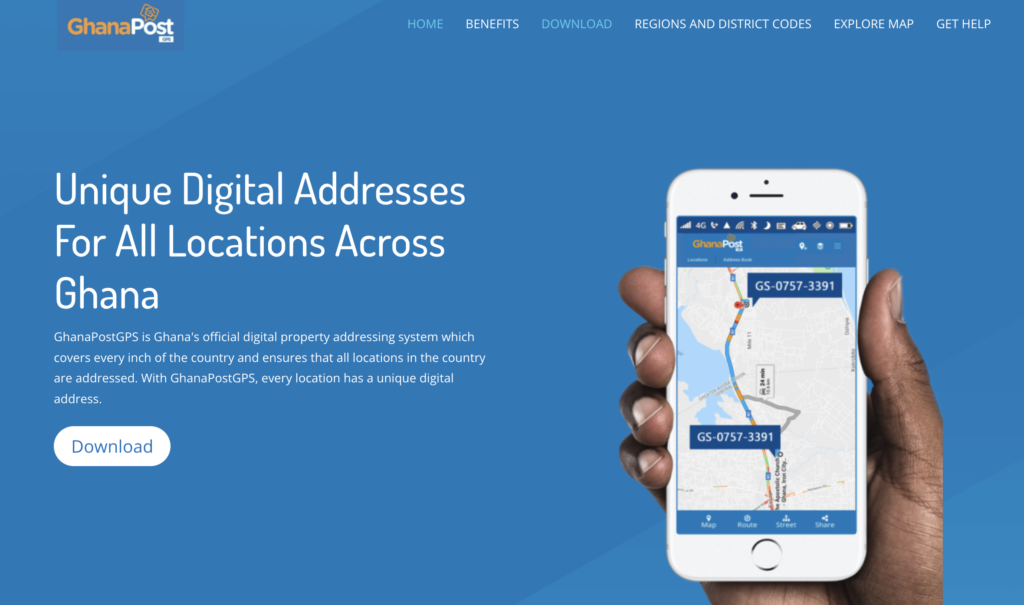
On the morning of October 18, 2017, President Nana Akufo-Addo stood before cameras and dignitaries at an Accra ceremony and unveiled what his government billed as a quiet revolution: a digital address for every square metre of Ghana.
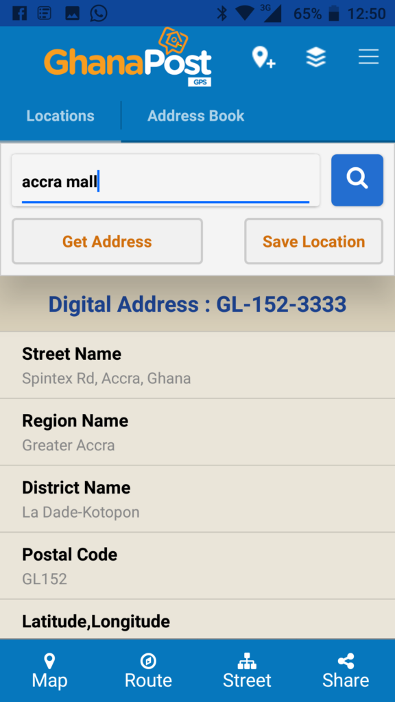
The system was called GhanaPostGPS. A smartphone application that would translate your GPS coordinates into an alphanumeric code like “GA-0329-4781”, encoding a region, district, and unique location.
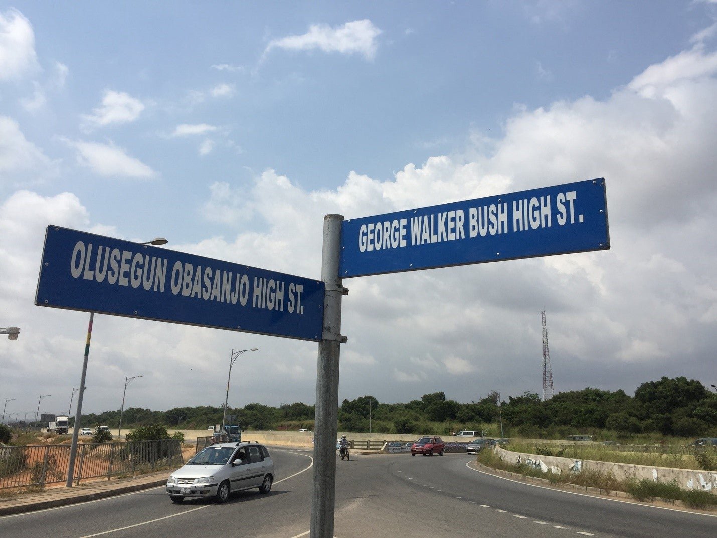
For a country long bedevilled by a culture of landmark navigation—“turn left at the mango tree, pass the blue kiosk”—it promised a reprieve.
Eight years on, that revolution remains unfinished.
The app still exists. Millions of Ghanaians carry their code on national identity forms and bank applications.
And yet a growing body of research, user experience reports, and public discourse suggests that GhanaPostGPS has become something of a digital paradox: ubiquitous on paper, scarce in practice.
A Vice President’s Digital Bet
It was former Vice President Dr. Mahamudu Bawumia who became the system’s most visible champion. A trained economist with a taste for digital transformation as a signature of his tenure, Dr. Bawumia announced the Ghana Digital Property Address System in 2017 as a centrepiece of the Akufo-Addo government’s broader digital economy agenda.
The contract to build the platform went to Vokacom (now Afrifanom Limited), a local Accra-based technology firm.
The price was $2.5 million—GHS 9.9 million at the time—and the system was licensed off AsaaseGPS, an application Vokacom’s CEO, Nana Osei Afrifa, had originally built in 2015 as an internal business tool to track rental properties.
The mechanics were straightforward in design: download the GhanaPostGPS app, verify your phone number, allow location access, and the system would assign a unique code tied to every five-by-five-metre plot in the country.

The digital address would be linked to the Ghana National Address Registry. Residents could register homes, businesses, and public spaces. Government agencies, banks, telcos, and emergency services would integrate it into their workflows.
At launch, President Akufo-Addo framed it as nothing less than the formalisation of Ghanaian space.
“Digital addresses will help formalize the economy by bringing more people into the tax system,” he declared, “and the system helps to improve property ownership data and bring efficiency to delivery service.”
Mr. Afrifa, CEO of Vokacom, echoed similar sentiments.
“The Vice President was accurate when he said some developed countries do not have the addressing system we have. Every square inch of Ghana has been digitised, post coded and addressed,” he said in November 2017.
Early Controversy
Within weeks of the launch, GhanaPostGPS was embroiled in a political and technical storm that would define its early reputation.
Critics, led most vocally by then-opposition leader John Mahama, argued that the government had effectively paid $2.5 million for something the public could access for free through Google Maps.
“How can you launch a Google GPS system that is freely available on our mobile phone and say it is a national addressing system?” Mahama demanded at a public gathering, calling the project a ‘419’. (the West African vernacular for fraud)
Civil society organisation the Coalition of Domestic Governance (CDG) took the critique further, convening a press conference at which US-based Ghanaian GPS expert Kingsley Mortey accused the project of being a “create, loot and share” scheme.
“In every interview that I have had so far, consistently, I say I want to stay away from saying that it is a scam,” Mortey said, “but the response that I am getting is pushing me to get to the kind of conclusion that it is.”
The CDG questioned the hosting arrangements—the app’s servers were on Amazon Web Services, even as Vokacom spoke of “national security” hardware—and challenged why the government was reportedly paying $400,000 per year to Google for API licensing when open-source alternatives existed.
CDG argued the application should not have cost more than $150,000.
(The $400,000 value has never been confirmed, and its real cost has been debated by local developers)
Former Communications Minister Ursula Owusu-Ekuful defended the contract, stressing that the $2.5 million figure represented the lowest bid among competing tenders.
“Somebody was going to charge us over GHS 100 million to develop the same application,” she told journalists on the Ministry’s decision to go with Vokacom.
The cost covered the full backend solution, data analytics, hardware including firewalls and servers, the Google Maps enterprise licence, marketing, and technical support, with GHS 1.7 million in VAT returning to government coffers.
Vokacom’s CEO Afrifa was blunt in response to the controversy. “We make $10 million a year,” he said in an interview. “We go and take a GHC 9.9 million contract—total profit coming to us isn’t even making 10% of our profit in a year.”
He disputed allegations of data security risks and denied claims of copying rival app SnooCODE, insisting AsaaseGPS had been developed independently since 2015. (SnooCODE officially launched its digital addressing system in 2011)
In 2018, Vokacom filed a GHS 3 million defamation suit against NDC communicator Sammy Gyamfi over statements made at a CDG press conference.
In 2021, the court dismissed the action, awarding costs against Vokacom.
Technical Faults
Beyond the politics, several technical and design problems undermined GhanaPostGPS from its earliest days.
The initial version of the application required an active internet connection to function—meaning it was inoperable in the rural and peri-urban areas where addressing problems were most acute.
Since the digital address was tied to GPS coordinates at the moment of generation, two occupants of the same house—one standing at the front, one at the back—could receive distinct codes.
This flaw made it functionally impossible to use the address as a stable, reliable identifier.
Buildings on the same street received codes with no logical sequential pattern—no even-and-odd numbering convention, no street-length logic.
The system also did not interface natively with Google Maps or other major navigation applications.
If you did not have the GhanaPostGPS app installed, a digital address was useless—it meant nothing to Uber, to Bolt, or to any mapping system outside Vokacom’s own platform.
An emergency services integration was built into the app with panic buttons linking to ambulance, police, and fire services. Researchers later confirmed it never functioned as advertised.
In an interview cited in a 2023 academic study by Ghanaian researchers from various universities using the Design-Reality Gap framework, an informant from the Ghana Ambulance Service confirmed that the emergency feature “did not work for emergency services during the time of the research team’s interview.”
Mandatory Use
Faced with limited voluntary uptake, the government turned to compulsion.
GhanaPostGPS was made a mandatory requirement for obtaining the National Identification Card, opening bank accounts, registering businesses with the Registrar General’s Department (now Office of the Registrar of Companies), applying for a passport, and accessing a range of government services.
The strategy worked, in a narrow sense.
Millions of Ghanaians generated a digital address—not out of utility, but compliance.
Researchers studying adoption in three suburban Accra communities found that about 68% of property owners were likely to use the system, compared to only 32% of renters, reflecting the practical reality that ownership created administrative incentives that tenancy did not.
But compliance was not the same as integration into daily life. A widely cited anecdote captures the gap: Ghanaians who shared their GhanaPostGPS code with Uber and Bolt drivers, believing the system was functioning as intended, were in fact sharing their live GPS coordinates—something the ride-hailing apps accessed independently of any digital address.
The Labari Journal reached out via email to the Ministry of Communications for comment on this story. We did not get a response by the time of publication.
Orphanhood
In December 2024, John Mahama—the same man who had called GhanaPostGPS a ‘419’—won the presidential election, ending eight years of NPP rule.
The irony was not lost on observers. The incoming NDC administration would be inheriting a system it had long derided.
Under the new Mahama government, the Ministry of Communication, Digital Technology, and Innovations was created, with Samuel Nartey George appointed as minister.
No formal announcement about the future of GhanaPostGPS has been made.
The app continues to function. A recent update added a ride-hailing service through a product called Mijo.

The system appears to be maintained, if not actively championed. This political discontinuity is a pattern analysts note across Africa’s smart-city initiatives.
“The digital addressing system was well launched, but subsequent political regimes did not exert much energy towards its continuity or improvement,” observed a 2024 analysis by Brickstone Africa.
“This political will inconsistency is one of the biggest challenges that most African countries have faced, whereby the change in government has caused initiatives under the previous regime to be abandoned or neglected.”
The Labari Journal reached out via email to Vokacom (Afrifanom Limited) for a comment on this story. They did not respond by the time of this publication.
Is GhanaPostGPS a Failure?
Some would argue that it would be unfair to declare GhanaPostGPS an unqualified failure. The system has delivered measurable, if imperfect, outcomes. The Registrar General’s Department now uses it for business registration.
The National Identification Authority (NIA) has used it to anchor biometric ID cards to verifiable locations.
Defenders of the system point to its role in reviving Ghana Post, a postal service that had been struggling for relevance against private couriers and digital communication.
The integration of digital addressing with postal services has enabled more systematic last-mile delivery, even if navigation remains limited.
Still, the gap between aspiration and reality is wide. Ghana’s informal urban fabric—unmapped lanes, unplanned settlements, renters who move frequently—does not submit easily to a code tied to GPS coordinates.
A 2022 study published by the University of Arizona’s College of Architecture, Planning, and Landscape Architecture found that decisions about the system were made centrally from the Vice President’s office with little input from local communities.
Doomed To Fail
Viewed from 2026, GhanaPostGPS is less a technological failure than an institutional one. The technical concept—uniquely coded digital addresses for every plot in a country where millions have never had one—was sound.
The problems were in execution: a top-down design that bypassed community input, a mandatory rollout that mistook compliance for adoption, a political personality cult around the system that made honest assessment difficult, and a change of government that left the platform without champions.
Academics studying the case through the Design-Reality Gap framework concluded that eight years of implementation had produced little they could confidently call success.
“The research found it difficult to confidently showcase any immediate successes arising out of the implementation of the GhanaPostGPS App,” the study noted.
For other West African governments contemplating similar initiatives, Ghana’s experience offers a cautionary map.
Digital addresses require more than an app. They require street-level mapping campaigns, community-level education, integration with existing navigation ecosystems, and the political continuity to see through a reform that will outlast election cycles.
Ghana still needs the system it was promised in 2017. The question now is whether the Mahama administration—once its fiercest critic—has the appetite to build it properly.


